Descriptions:
- With a large scanning range, fine angular resolution and high sensitivity, the picoScan100 2D LiDAR sensor. It also reliably detects small and dark objects. The sensor delivers exact measurement data and features integrated processing of data that is transmitted through various communication interfaces.
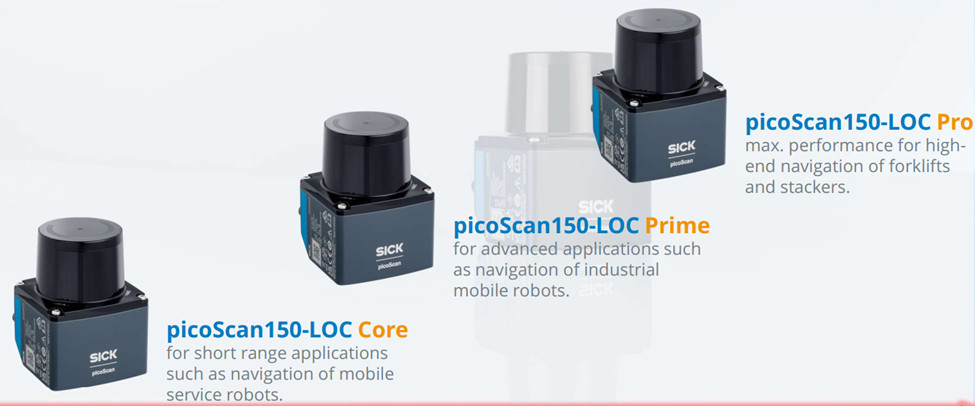
- The picoScan150-LOC is a full contour localization solution for mobile robot applications
- The compact picoScan100 equipped with multi-echo technology has a rugged housing and ensures reliable measurement results even under harsh ambient conditions.
- It can be used in demanding industrial applications both in- and outdoors.
- The picoScan100, available in three variants (Core, Prime and Pro), can also be adapted with other features to meet individualized requirements.
Features:
- Compact, rugged housing
- Scanning range: 75 m (90 % remission); angular resolution: 0.5° to 0.05°
- Dynamic Sensing Profiles
- High measurement accuracy – measurement noise, scan field flatness and angular accuracy
- Scanning frequency: 15 Hz to 50 Hz
- Multi-echo technology
- Drivers: ROS, C++ and Python
- System plug with config. Memory
Technical information:
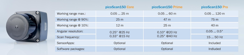
- Core: With the picoScan150 Core, you receive a high performance sensor with a working range of up to 25 m that covers a wide range of applications. Additional SensorApps and software functions can optionally be ordered.
- Prime: With a working range of up to 60 m, this version is ideal for demanding applications such as localizing autonomous mobile robots or mapping large spaces. Thanks to numerous optional SensorApps and software functions, you can precisely tailor the picoScan150 Prime to your requirements.
- Pro: This version offers a scanning range of up to 120 m and full access to the available SensorApps and all software functions. With the picoScan150 Pro, you receive the ideal combination of powerful measurement performance and a high level of flexibility.
Application:
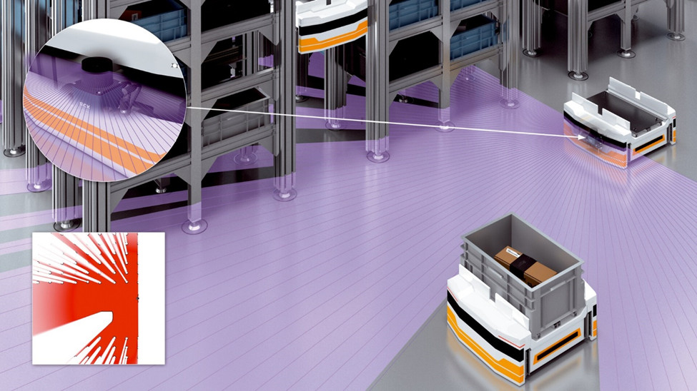
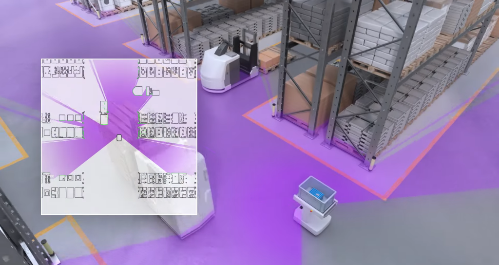
AMR sử dụng dữ liệu đo của picoScan100 để tạo bản đồ chính xác về môi trường của chúng. Vị trí và tuyến đường hiện tại của AMR có thể được xác định dựa trên các điểm mốc bên trong bản đồ này.
AMRs use the measurement data of the picoScan100 to create a precise map of their environment. The current position and route of the AMR can be determined based on landmarks inside this map.
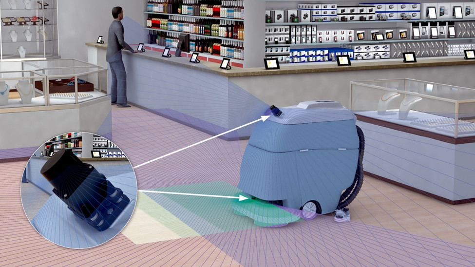
Service robots often move about in a dynamic environment. With the help of the integrated field evaluation, the picoScan100 reliably detects objects in its path and can drive around them.
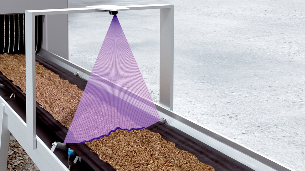
The picoScan100 is also ideal for a wide variety of stationary applications. Its precise measurement data can, for example, be used to capture profile lines from which a volume flow can be calculated.